|
Today |
Tonight |
|
Partly Cloudy  HIGH: 89° HIGH: 89°
Chance of Precip: 0%
UV Index: 10
Partly Cloudy. Winds NW at 11 to 16 mph.
|
Mostly Clear  LOW: 82° LOW: 82°
Chance of Precip: 0%
Mostly Clear. Winds WSW at 10 to 15 mph.
|
|
Tomorrow |
Tomorrow Night |
|
Isolated Storms  HIGH: 91° HIGH: 91°
Chance of Precip: 23%
UV Index: 10
Partly Cloudy with Isolated Storms. Winds NNW at 8 to 13 mph.
|
Chance of Storms  LOW: 82° LOW: 82°
Chance of Precip: 32%
Partly Cloudy with Chance of Storms. Winds W at 9 to 13 mph.
|
|
Sunday |
Sunday Night |
|
Isolated Storms HIGH: 90°
Chance of Precip: 24%
Precip Amount: 0.01"
UV Index: 10
Partly Cloudy with Isolated Storms. Winds NNW at 9 to 13 mph. |
Chance of Storms LOW: 82°
Chance of Precip: 34%
Precip Amount: 0.02"
Partly Cloudy with Chance of Storms. Winds W at 8 to 12 mph. |
|
Monday |
Monday Night |
|
Isolated Storms HIGH: 91°
Chance of Precip: 20%
Precip Amount: 0.01"
UV Index: 10
Partly Cloudy with Isolated Storms. Winds NNW at 7 to 11 mph. |
Isolated Storms LOW: 82°
Chance of Precip: 28%
Precip Amount: 0.01"
Partly Cloudy with Isolated Storms. Winds SW at 6 to 11 mph. |
|
Tuesday |
Tuesday Night |
|
Showers  HIGH: 91° HIGH: 91°
Chance of Precip: 17%
UV Index: 11
Partly Cloudy with Showers. Winds NNW at 6 to 12 mph.
|
Isolated Storms LOW: 83°
Chance of Precip: 14%
Partly Cloudy with Showers and Isolated Storms. Winds SW at 8 to 12 mph. |
|
Wednesday |
Wednesday Night |
|
Isolated Storms HIGH: 91°
Chance of Precip: 19%
UV Index: 0
Partly Cloudy with Isolated Storms. Winds W at 7 to 14 mph. |
Isolated Storms LOW: 83°
Chance of Precip: 23%
Precip Amount: 0.10"
Partly Cloudy with Showers and Isolated Storms. Winds SW at 9 to 15 mph. |
|
Thursday |
Thursday Night |
|
Isolated Storms HIGH: 89°
Chance of Precip: 15%
Precip Amount: 0.03"
UV Index: N/A
Partly Cloudy with Isolated Storms. Winds N at 8 to 16 mph. |
Isolated Storms LOW: 84°
Chance of Precip: 15%
Precip Amount: 0.04"
Partly Cloudy with Isolated Storms. Winds WSW at 7 to 13 mph. |
|
Friday |
Friday Night |
|
Isolated Storms HIGH: 89°
Chance of Precip: 15%
UV Index: N/A
Partly Cloudy with Isolated Storms. Winds NNE at 7 to 12 mph. |
Isolated Storms LOW: 84°
Chance of Precip: 15%
Partly Cloudy with Isolated Storms. Winds SW at 6 to 11 mph. |
|
Saturday |
Saturday Night |
|
Showers HIGH: 87°
Chance of Precip: 65%
Precip Amount: 0.05"
UV Index: N/A
Partly Cloudy with Showers. Winds NW at 6 to 13 mph. |
Showers 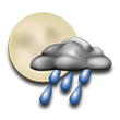 LOW: 84° LOW: 84°
Chance of Precip: 10%
Partly Cloudy with Showers. Winds SW at 8 to 13 mph.
|
|
Sunday |
Sunday Night |
|
Showers HIGH: 87°
Chance of Precip: 85%
Precip Amount: 0.07"
UV Index: N/A
Partly Cloudy with Showers. Winds WSW at 8 to 15 mph. |
Rain  LOW: 84° LOW: 84°
Chance of Precip: 100%
Precip Amount: 0.37"
Partly Cloudy with Light Rain Likely. Winds SW at 9 to 16 mph.
|
|
Monday |
Monday Night |
|
Rain 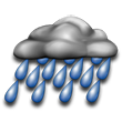 HIGH: 86° HIGH: 86°
Chance of Precip: 100%
Precip Amount: 0.30"
UV Index: N/A
Partly Cloudy with Light Rain Likely. Winds W at 9 to 16 mph.
|
Partly Cloudy  LOW: 84° LOW: 84°
Chance of Precip: 0%
Partly Cloudy. Winds SW at 16 to 16 mph.
|
|
Tuesday |
Tuesday Night |
|
Mostly Sunny  HIGH: 85° HIGH: 85°
Chance of Precip: 0%
UV Index: N/A
Mostly Sunny. Winds W at 17 to 18 mph.
|
Partly Cloudy LOW: 84°
Chance of Precip: 0%
Partly Cloudy. Winds SW at 16 to 22 mph. |
|
Wednesday |
Wednesday Night |
|
Mostly Sunny HIGH: 85°
Chance of Precip: 0%
UV Index: N/A
Mostly Sunny. Winds W at 16 to 18 mph. |
Clear  LOW: 83° LOW: 83°
Chance of Precip: 0%
Clear. Winds SW at 19 to 22 mph.
|
|
Thursday |
Thursday Night |
|
Sunny  HIGH: 84° HIGH: 84°
Chance of Precip: 0%
UV Index: N/A
Sunny. Winds W at 16 to 19 mph.
|
Clear LOW: 83°
Chance of Precip: 0%
Clear. Winds SW at 18 to 25 mph. |


 1
1 2
2 3
3 4
4 5
5 6
6 7
7 8
8